Day 6. Rasac Pass.
Summary: This is the second most technical day on the Circuit. The majority of the terrain is straightforward. Some glacier travel, a brief loose gully ascent, a somewhat convoluted, potentially confusing descent, and a 20m 4th class down climb will keep you on your toes. The views of Rasac and its West Summit on the ascent are a highlight.
Elevation Gain: 550m Elevation Loss: 700m Time: 5h Distance: 5km
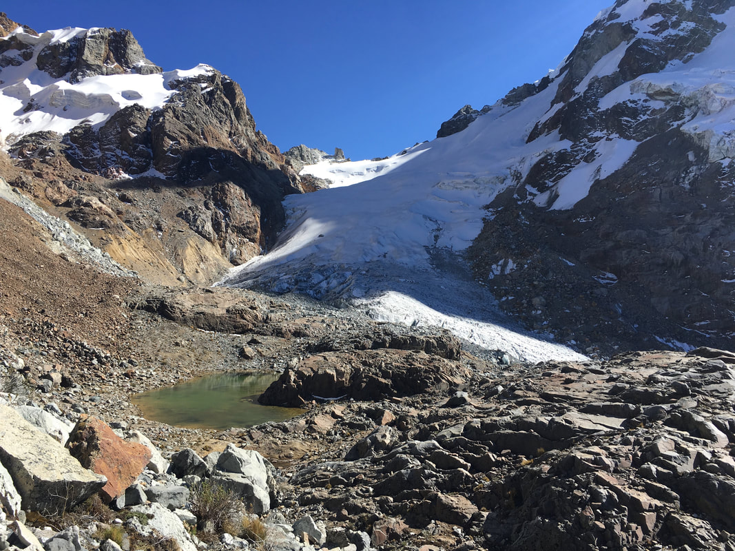
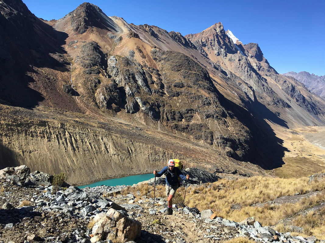
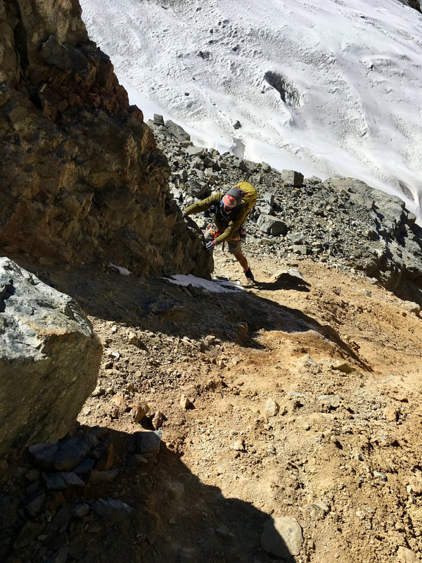
Ascent: Start at camp beside Caramarca Lake (4575m). Hike up the crest of a moAccess Issuesraine immediately W of the lake to gain a boulder-strewn plateau. Boulder hop past a small lake to the edge of the Seria Glacier (2h). Hike up the glacier (15 degrees), passing a few minor crevasses. Unavoidably, the route crosses an avalanche path coming off Rasac Oeste. The glacier culminates in a 35-degree 50m headwall just below the pass. Either crampon up the headwall or step left onto a rocky bench and scramble around the headwall on easy talus. Above the headwall, turn left (W), walk horizontally on scree under a rocky cliff then climb 8m of exposed 5.0 rock (hands and right foot) and sand (left foot) - or keep your crampons on and walk up the sand - to reach the minor West Col 100m west of Rasac Pass. 3h from Caramarca to the Col.
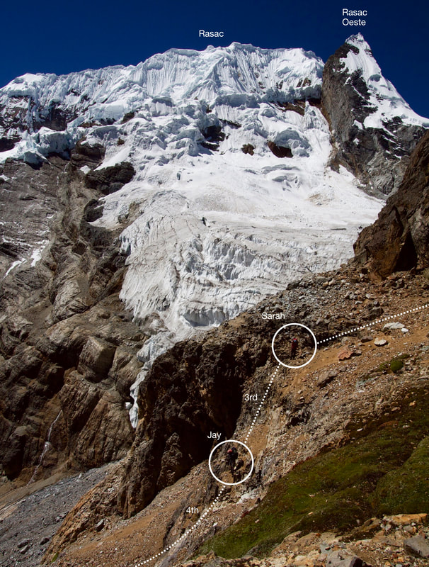
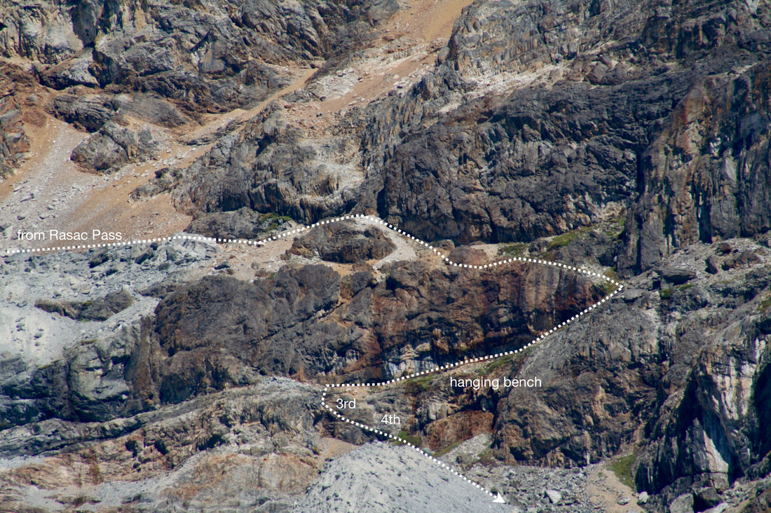
Descent: The first 1km of descent is not intuitive. Pay close attention to the instructions. Boulder hop downwards for 50m from the West Col then traverse horizontally left (toward the NW), just below cliffs on Huacrish Norte, for 700m. Look for a place where you can walk straight down hill and then double back toward the E along a hanging bench (4h from Caramarca). Many cairns mark the bench but they are not easy to spot from a distance. Traverse the bench toward the east, staying high, then descend via a 20m 4th class downclimb (3rd class at the top, then traverse W on ledge with positive handholds) to reach the top of a grassy moraine. The rest is walking. Walk along micro-valleys past Barrosococha and then join the cows and camp near Rasacocha. Continuing on to the Jauacocha Valley is not recommended because the locals may not welcome camping anywhere other than the W end of Jauacocha (fee), which is 3km off route.
Almost immediately, a small section broke away beneath Harrah; and he was pitched over the western precipice. Fortunately, the 120 or more feet of rope were neatly coiled; and Harrah fell the entire distance, giving Maxwell time to grab his axe as it, too, started to fall, throw himself prone on the ridge top, and drive the axe into the snow. (There are arguments both pro and con jumping over the other side of the ridge.) Harrah, though festooned with pitons, crampons and axes, was not punctured by them, because he fell free about 50 feet and then hit nothing worse than 75-degree ice... Without surprise, without gratitude, he felt a sickening jerk at his middle. The stretch in the nylon had absorbed much of the shock; his ribs had absorbed the rest.
~ Graham Matthews & David Harrah, 1951
